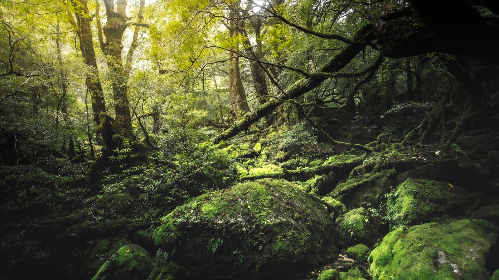
Yakushima is a round, mountainous island about 132 km in circumference off the southern tip of Kyushu, and in December 1993 it became, with Shirakami-Sanchi, one of Japan's first two natural World Heritage Sites. Most visitors come for the cedar forest: the moss at Shiratani Unsuikyo, the short trails of Yakusugi Land, and the Jomon Sugi, a cedar 22.2 m tall that stands about 11 km up a trail from the Arakawa trailhead, a walk of 8 to 10 hours there and back. From March 1 to November 30 the road to that trailhead is closed to private cars, and hikers ride a shuttle bus from the Yakusugi Museum stop.
This guide covers getting to the island, the two forest parks, the Jomon Sugi hike with its bus rules and mountain fee, the waterfalls and tidal hot spring of the south coast, the loggerhead turtles at Nagata, and where to stay. A typhoon in September 2026 closed several trails, and we note what had reopened on the official pages when we read them on October 31, 2026. Where the island sits in a wider trip is covered in Kyushu: Where to Go After Tokyo and Kyoto.
Key points
- JAC flies to Yakushima from Kagoshima in about 40 minutes, four to eight times a day, and once a day each from Fukuoka and Osaka Itami. The Toppy and Rocket jetfoils from Kagoshima take about 1 hour 50 minutes to 3 hours.
- The Jomon Sugi is about 11 km one way from the Arakawa trailhead, 8 to 10 hours return. From March to November the first shuttle bus leaves the Yakusugi Museum stop at 5:00, and a return ticket is ¥3,000 including the ¥1,000 day-hike mountain fee.
- Shiratani Unsuikyo and Yakusugi Land each ask ¥800 per adult. Shiratani reopened on October 18, 2026 after the typhoon, with some routes still closed.
- Hirauchi Kaichu Onsen is a hot spring on the shore that can be used only for about two hours either side of low tide, twice a day.
- Loggerhead turtles nest at Nagata from late April to early August. Watching them at night is by a guided observation session only, May 10 to July 15, ¥2,000 per adult.
LET US ARRANGE YOUR DAYS ON YAKUSHIMA →
THE ISLAND AND ITS RAIN
Kagoshima Prefecture describes Yakushima as an island of more than 45 peaks over 1,000 m, crowned by Miyanouradake at 1,936 m, the highest mountain in Kyushu. The mountains catch the rain. The prefecture gives annual rainfall of more than 4,000 mm in the lowlands and 8,000 to 10,000 mm in the mountains, against about 2,300 mm in Kagoshima City.
- The cedars. Natural cedars over 1,000 years old are called yakusugi; younger ones are kosugi. The prefecture says they grow between roughly 600 m and 1,800 m, and that more than 1,900 plant species grow on the island.
- The World Heritage area. The Ministry of the Environment records the inscription on December 11, 1993. The listed area is about 10,747 hectares, roughly a fifth of the island, valued for its old cedar forest and for vegetation that runs from subtropical coast to subalpine bamboo grass.
- What the rain means for a visit. Rain gear belongs in every day bag, and trails close after heavy weather.
GETTING TO YAKUSHIMA
There is no train. The island is reached by air or by sea, and Kagoshima is the hub for both.
By air
Japan Air Commuter, a JAL group airline, flies to Yakushima Airport. The Yakushima Tourism Association gives these times and frequencies:
| From | Flight time | Flights a day |
|---|---|---|
| Kagoshima | About 40 minutes | 4 to 8 |
| Fukuoka | About 1 hour 10 minutes | 1 |
| Osaka Itami | About 1 hour 50 minutes | 1 |
The association notes that seats fill up in some seasons. From Tokyo, the usual route is a flight to Kagoshima and the short hop onward.
By sea
Jetfoil. Tanegashima Yakushima High-Speed Boat runs the Toppy and Rocket jetfoils from the South Pier of Kagoshima Port to Miyanoura or Anbo, some calling at Ibusuki or Tanegashima on the way. The tourism association gives about 1 hour 50 minutes to 3 hours, with six sailings a day; the number changes by season. The operator's own timetable page did not open for us, so we do not quote departure times.
Ferry. Ferry Yakushima 2 sails once a day from the same pier to Miyanoura in about four hours, and carries cars.
Miyanoura, on the northeast coast, is the port for Shiratani Unsuikyo. Anbo, on the east coast, is closer to Yakusugi Land and to the Arakawa trailhead road.
SHIRATANI UNSUIKYO AND YAKUSUGI LAND
Both forest parks are Natural Recreation Forests, designated in 1974 and run by the Yakushima Recreation and Forest Conservation Management Committee. From April 1, 2026 each asks a forest conservation contribution of ¥800 for high school students and older, ¥600 per person for groups of 20 or more.
Shiratani Unsuikyo
Shiratani lies at 600 to 1,050 m, about 10 km and 25 minutes by car from Miyanoura, with route buses from the port. The committee's 2026 leaflet gives three walks: the Yayoisugi course of about 1 hour 10 minutes, the Bugyosugi course of about 3 hours, and the Taikoiwa rock round trip of about 4 hours. The moss forest along the Kusugawa trail, the committee writes, inspired the setting of the film Princess Mononoke. The Yayoisugi cedar that gave the shortest course its name fell in a typhoon in 2024.
After the September 2026 typhoon. Shiratani reopened on October 18, 2026. On the notice we read, part of the Yayoisugi course, the Hiryu bridge and walkway, and the stretch beyond the second car park were still closed, while the Taikoiwa and Bugyosugi courses had been repaired and were open. The water at the Shiratani hut was not drinkable.
Walking on to the Jomon Sugi. A trail runs from Shiratani over the Tsuji pass toward the Wilson stump and the Jomon Sugi. Walking within Shiratani needs only the ¥800 contribution; going beyond the Tsuji pass also needs the mountain fee described below.
Yakusugi Land
Yakusugi Land covers 270 hectares at 1,000 to 1,300 m, about 15 km from Anbo. Five courses run from 30 to 210 minutes, past named cedars such as the Buddhasugi, which the committee's leaflet puts at about 1,800 years. After the typhoon a landslide closed the Seiryo suspension bridge on the way out, and a temporary exit path of about 20 m leads around it.
THE JOMON SUGI HIKE
The Jomon Sugi was introduced to the public in 1966. Yakushima Town gives its height as 22.2 m and its girth at chest height as 16.1 m, at an altitude of 1,328 m, and says it is said to be 2,170 to 7,200 years old. The Forestry Agency's Kyushu office, whose survey produced the height and girth figures, gives its own estimate of 1,300 to 3,600 years, with a median of 2,400. Visitors look at it from a wooden deck that keeps them off the roots.
The trail
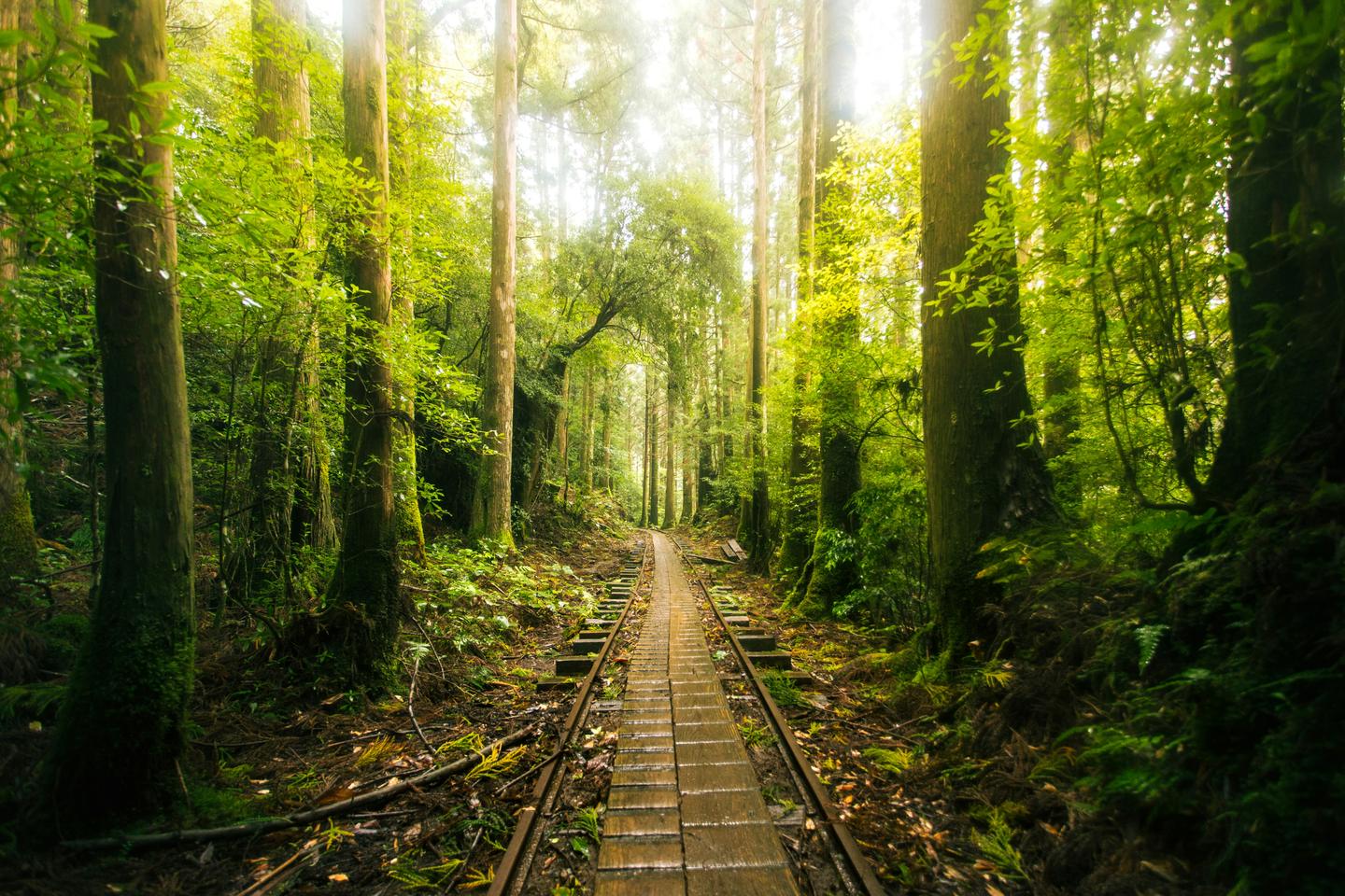
The town gives about 11 km one way from the Arakawa trailhead, 4 to 5 hours each way and about 8 to 10 hours for the round trip, with about 700 m of climb. BE-PAL's guide to the day hike, written by a certified mountain guide, describes the first 8 km or so as an old logging railway, wide enough for one person and slippery after rain, and lists a headlamp, rain gear top and bottom, a map and a portable toilet among the things to carry.
The bus and the closed road
Every year from March 1 to November 30, the town road to the Arakawa trailhead is closed to private cars, rental cars, motorbikes and bicycles. Hikers leave their car at the Yakusugi Museum stop and take the Arakawa shuttle bus, about 35 minutes. Taxis and chartered buses may still drive up. This is the 2026 timetable from the mountain council:
| Direction | Departures |
|---|---|
| Yakusugi Museum to Arakawa trailhead | 5:00, 5:20, 5:40, 14:00 |
| Arakawa trailhead to Yakusugi Museum | 6:20, 15:00, 16:00, 16:30, 17:00, 17:45 |
The 5:20 departure and the 16:30 return do not run in June. Seats cannot be reserved, the early buses are limited in number, and if one is full you take the next. A hiker who misses the last bus down takes a taxi. The council asks hikers to buy tickets by the day before, at the tourism association's offices in Miyanoura, in Anbo and at the airport, or at some hotels; they are also sold at the bus stop in the morning.
The mountain fee and the toilets
The World Heritage Yakushima mountain environmental conservation contribution is ¥1,000 for a day hike and ¥2,000 for a hike with a night in the mountains, for junior high school students and older, paid once per trip. It funds trail repairs and the mountain toilets. A return bus ticket is ¥3,000, which is ¥2,000 of fare and the ¥1,000 day fee; a hiker arriving by taxi pays the fee at the bus stop or at the gate on the road. In August 2026 the council announced that the toilets at Kosugidani and at the end of the railway track could not be used after typhoon damage, and asked hikers to carry portable toilets.
The typhoon in September 2026. The shuttle bus was suspended from September 9 and ran again from September 17, when the Jomon Sugi trail reopened. The council recommends going with a mountain guide while the ground stays loose after heavy rain.
WATERFALLS AND THE TIDAL HOT SPRING
The south and west coasts make a gentler day.
- Senpiro Falls. Water falls about 60 m down a single great slab of granite into a V-shaped valley. The town gives about 23 minutes by car from Anbo, turning inland near Mugio; it warns that map apps misplace the road. There is parking for 25 cars, and the nearest bus stop is an hour's walk away.
- Ohko Falls. At 88 m, it is one of the island's largest falls and one of the 100 Waterfalls of Japan, selected in 1990. The path from the car park below the road is step-free, and you can stand close to the basin. It is about 55 minutes by car clockwise from Anbo, near Kurio. The Japan Tourism Agency's description warns that in the rainy and typhoon months, July to October, the river can flood up to the car park.
- Hirauchi Kaichu Onsen. Hot water rises in the rocks on the shore at Hirauchi and can be used only for about two hours either side of low tide, twice a day. There are two pools, bathing is mixed, and swimsuits and underwear are not allowed; a bath towel wrapped around you or a bathing robe is. The town lists the fee as a ¥300 donation.
Low tide sets the hour for Hirauchi, so we place the falls around it. How a public hot spring works, and what to expect in a mixed bath, is in Japan's Onsen Culture: What to Know.
LOGGERHEAD TURTLES AT NAGATA
On the northwest coast at Nagata, three beaches were listed together as the Ramsar wetland Yakushima Nagata-hama in November 2005: Maehama and Inakahama, each about 1 km long, and Yotsusehama, about 0.2 km. The Ministry of the Environment says about 30 to 40 percent of the loggerheads that come ashore in Japan do so here. They nest from late April to early August, and the eggs hatch from early July to late September.
- Observation sessions. Watching nesting at night is by organised session only, held at Inakahama from May 10 to July 15. Check-in is 20:00 to 20:30, a talk runs 20:30 to 21:30, and observation from 21:30 to 23:00. The fee is ¥2,000 for adults and ¥500 for junior high school students and younger, for up to 50 people a night, reserved in advance.
- The rules. Lights off, no cameras or video, no touching, quiet, and no going back on the beach after the session ends.
- The beach at night. From May 1 to September 30, visitors are asked not to enter the beach between 20:00 and 5:00 outside the sessions.
The turtles are wild, and the organisers say plainly that a night may pass without one coming ashore.
WHERE TO STAY
Miyanoura is the base for Shiratani and the north. Anbo and the south coast are closer to Yakusugi Land, the Arakawa road, Senpiro Falls and Hirauchi.
sankara hotel & spa yakushima
At Mugio on the south coast, sankara has 29 rooms in four types: Sankara Suite, Sankara Junior Suite, Sankara Villa Suite and Manasa Villa. The hotel says the junior suites were renovated in April 2026 and the villa suites, which have a sauna on the balcony, in May 2026. Ikyu's listing gives 53 m² for a Manasa Villa and 71 m² for a Sankara Junior Suite, and states that children under 13 are not accepted.
Dinner is at Okas, a full course, or Ayana, a prix fixe; breakfast uses bread from the hotel's own baker. The spa is Spa Sankara Sana, and Sauna Agni is built of local cedar. The hotel's site shows One MICHELIN Key for 2026, and Ikyu's listing gives the Key for 2024, 2025 and 2026. Transfers from Yakushima Airport, about 40 minutes, and from Anbo port, about 25 minutes, are free when arranged in advance.
On October 31, 2026 the lowest rate Ikyu displayed was ¥66,647 for two people with breakfast, tax included, for a Manasa Villa with a forest view on a limited December to February plan. The same listing notes that the hotel closes for maintenance from January 12 to February 18, 2027.
How to choose between a hotel and a traditional inn elsewhere on a trip is in How to Choose a Ryokan in Japan.
HOW WE ARRANGE DAYS ON YAKUSHIMA
We plan around the bus timetable, the tides and the trail notices, and arrange the parts in your name.
- A certified guide. Yakushima Town certifies guides who have passed its own examination, carry insurance and are trained in first aid, and who live on the island. We arrange one for the forest days and for the Jomon Sugi. What a private guide costs in Japan is set out in How Much Does a Private Guide in Japan Cost per Day?
- The early start. For the Jomon Sugi we arrange a taxi or car from the hotel in the dark, the portable toilets and the packed breakfast and lunch, and we check the council's notices the evening before.
- Getting there. We tell you which flight or jetfoil fits the plan. You buy the tickets yourself.
- The stay. We arrange the hotel in your name and you pay it directly, with the airport or port transfer set for your arrival.
- The turtles. In season we arrange places at the Nagata observation session and the drive there and back.
SOURCES AND HOW WE CHECKED
Read on October 31, 2026. Prices include tax and are for one adult unless stated.
- Yakushima Mountain Conservation and Use Council, vehicle restriction and Arakawa bus, mountain fee and trail status after Typhoon 24: restriction period, bus timetable and fares, fee amounts, ticket offices, closed toilets, reopening dates
- Yakushima Town, Jomon Sugi: 1966, size, altitude, trail distance and time, climb
- Yakushima Town, Senpiro Falls, Ohko Falls and Hirauchi Kaichu Onsen: heights, drive times, parking, bathing hours, rules and fee
- Yakushima Recreation and Forest Conservation Management Committee, with its Shiratani and Yakusugi Land leaflets: 2026 contribution, courses, altitudes, typhoon closures and the temporary exit
- Yakushima Tourism Association, getting to Yakushima and Jomon Sugi: flight times and frequencies, jetfoil and ferry
- Kagoshima Prefecture, the nature of Yakushima: peaks, rainfall, yakusugi, plant species
- Ministry of the Environment, Yakushima World Heritage Center, registration and World Heritage area: December 11, 1993, area and values
- Forestry Agency Kyushu Regional Forest Office, Jomon Sugi: survey size and the 1,300 to 3,600 year estimate
- Ministry of the Environment, Ramsar Sites in Japan: Yakushima Nagata-hama and Yakushima sea turtles: November 2005, the three beaches, nesting and hatching months, share of Japan's loggerheads
- Yakushima sea turtle committee, Nagata observation sessions, rules and night access: dates, times, fee, capacity, rules
- Japan Tourism Agency, multilingual descriptions: Ohko Falls: 1990 selection, flooding season
- sankara hotel & spa yakushima, rooms, dining, access and MICHELIN Key news: room types, renovations, restaurants, spa, transfers, Key
- Ikyu, sankara hotel & spa yakushima: 29 rooms, room sizes, age policy, Key years, lowest rate shown on October 31, 2026, winter closure
- BE-PAL, a day hike to the Jomon Sugi: the logging railway section and what to carry
- Nippon Tabi Magazine, Jomon Sugi: the viewing deck
- Yakushima Town, certified guides: what certification means and how guides are chosen
QUESTIONS GUESTS ASK
How long is the hike to the Jomon Sugi?
About 11 km each way from the Arakawa trailhead, with about 700 m of climb. Yakushima Town gives 4 to 5 hours one way and 8 to 10 hours for the round trip. From March to November the first shuttle bus leaves the Yakusugi Museum stop at 5:00 and the last bus down leaves the trailhead at 17:45.
How much is the Yakushima mountain fee?
¥1,000 for a day hike and ¥2,000 if you spend a night in the mountains, for junior high school students and older. On the Arakawa bus it is paid with the ticket: a return ticket is ¥3,000, including the ¥1,000 day fee. Shiratani Unsuikyo and Yakusugi Land ask a separate ¥800.
How do I get to Yakushima?
By air, JAC flies from Kagoshima in about 40 minutes, four to eight times a day, and once a day from Fukuoka and from Osaka Itami. By sea, the Toppy and Rocket jetfoils from Kagoshima take about 1 hour 50 minutes to 3 hours, and Ferry Yakushima 2 takes about four hours.
Can I see the sea turtles at Nagata?
At night, only on an organised observation session at Inakahama, held from May 10 to July 15, 20:00 to 23:00, for ¥2,000 per adult and up to 50 people. Lights and cameras are not allowed, and nesting is never guaranteed.
How many days do I need on Yakushima?
The Jomon Sugi takes a full day on its own, starting before 5:00. With a forest park, the south coast and a day held in reserve for rain, three or four nights let you see the island without hurrying.
LET US ARRANGE YOUR DAYS ON YAKUSHIMA
Send us your dates and how you would like to spend them on the island. We will come back with a plan built around the bus timetable, the tides and the trail notices, the flight or jetfoil that fits it, and a stay with its published rates, and we arrange the guide, the car and the hotel you choose.
Begin planning →We reply within 24 hours, in writing
Some of the restaurants, bars and private places we arrange take guests only by introduction or membership. We do not publish their names.